
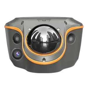

CHCNAV ViLi i100

CHCNAV ViLi i100

Highlights

The ViLi i100 GNSS RTK Receiver integrates advanced satellite filtering, SFix 2.0 positioning and the latest Vi-LiDAR technology to deliver reliable centimetre-level accuracy. It supports accurate positioning and reliable performance in challenging GNSS environments, enabling professionals to achieve faster and more efficient surveying results.

Confident-and-Consistent-Accuracy-in-Obstruction

Confident and Consistent Accuracy in Obstruction

5 cm accuracy, even in challenging GNSS environments. Once right, always right.

Enhanced-SFix-2-Engine

Enhanced SFix 2.0 Engine

5 cm accuracy within 20 m in GNSS-denied Areas.

3D-Point-Cloud-Earthwork-Calculation

3D Point Cloud Earthwork Calculation

Simply scan, define the boundary, and get instant results with 99.98% accuracy.

Vi-LiDAR-Contactless-Survey

Vi-LiDAR Contactless Survey

Capture a photo once and extract survey points in batches.

GNSS-obstructed-Environments

GNSS-obstructed Environments

GNSS-denied Environments

Earthwork Volume Calculation

Contactless Surveying

Positioning
  • GNSS : Full GNSS
  • IMU : 200 Hz
  • Precision max. : 0.8 cm H / 1.5 cm V
Sensors
  • Camera : Four
Connectivity
  • Wireless : Bluetooth, Wi-Fi
  • Modem : 410 – 470 MHz, Rx only
  • Ports : 1 x USB V3.0 Type-C port, 1 x UHF antenna port
Physical
  • Weight : 1.39 kg
  • Screen size : 208 x 162 x 95.5 mm
LiDAR
  • Range : 30 m @ 10% reflectivity 70 m @ 80% reflectivity
  • FOV : H: 360° V: 90°
  • Eye – Safety Class : Class 1 (EC60825 – 1:2014) eye – safe
  • Point Frequency : 860,544 pts/s (single – echo mode)
  • Accuracy (Typical) : 1.5 cm (1 σ)
Environmental
  • Operating : -20°C to +55°C
  • Protection rating : IP67
  • Drop resistance : 2 Metres